Landsat 8 satellite captures tidal flats of the Bijagós archipelago in Guinea-Bissau
04.10.2026, 14:56·
COLLECTED AND VERIFIED AUTOMATICALLY
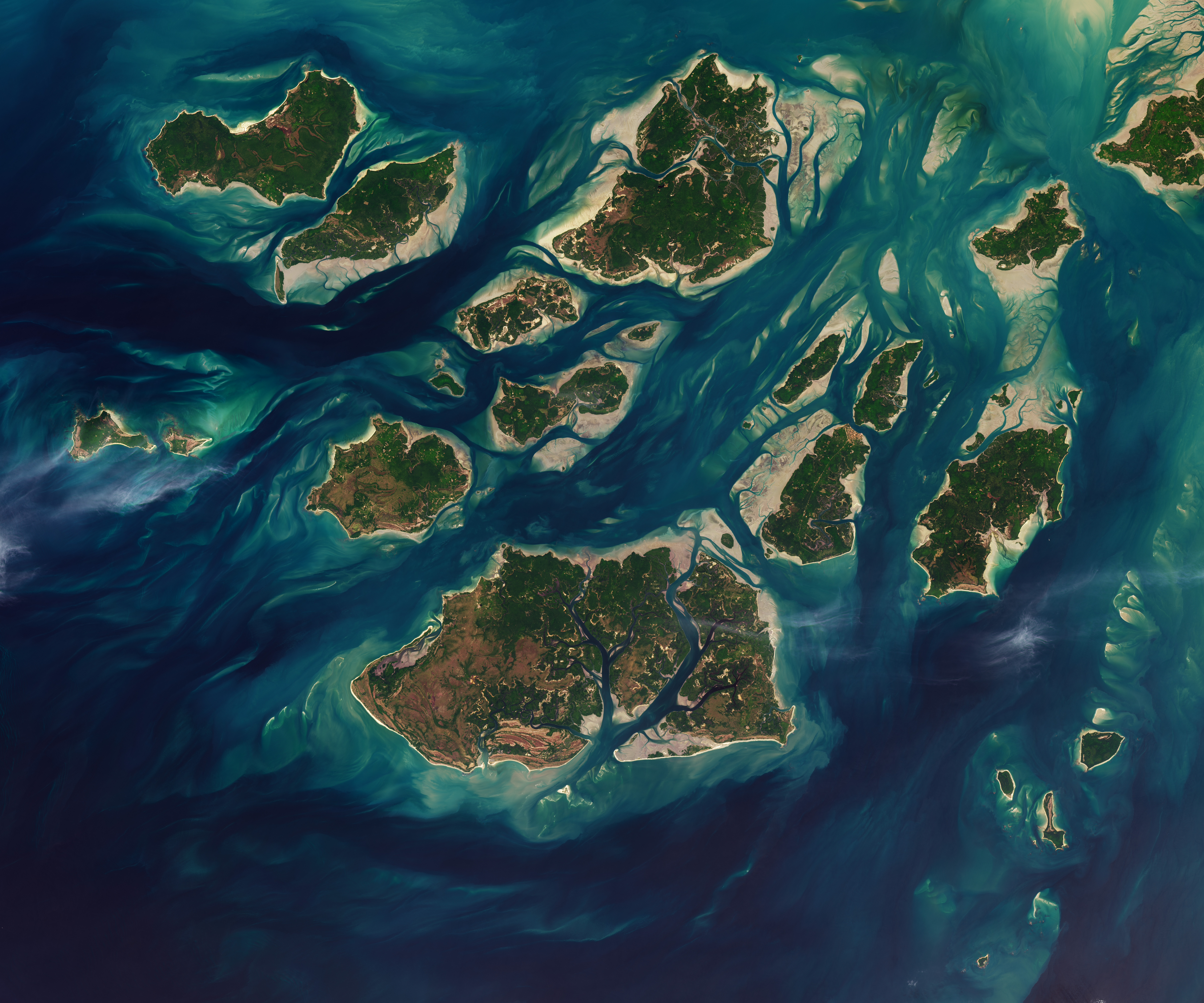
An image acquired on November 28, 2025 using the OLI (Operational Land Imager) instrument aboard the Landsat 8 satellite captured the Bijagós archipelago off the coast of Guinea-Bissau during a relatively low tide. During the tidal retreat, extensive sandy and muddy flats became exposed, forming a unique coastal landscape in this region of West Africa.
The Bijagós archipelago consists of dozens of islands and is considered one of the most pristine marine ecosystems on the African continent. The flats visible in the satellite image serve as a habitat for numerous invertebrate organisms, including mollusks and crustaceans, which are an important food source for birds.
Thanks to its abundant food resources, the Bijagós archipelago is a popular stopover site for migratory shorebirds traveling along transatlantic and Afro-Eurasian migration routes. These birds use the coastal flats for rest and replenishment of energy reserves during long seasonal migrations.
Remote sensing data, such as this image, help scientists monitor changes in coastal ecosystems, including the dynamics of tidal zones and the habitat condition of migratory species. Such monitoring is particularly important for conserving biodiversity in regions like Bijagós, which play a key role in global bird migration networks.
This article was generated and published automatically from verified sources. If you spot an inaccuracy, it will be corrected on the pipeline's next pass.